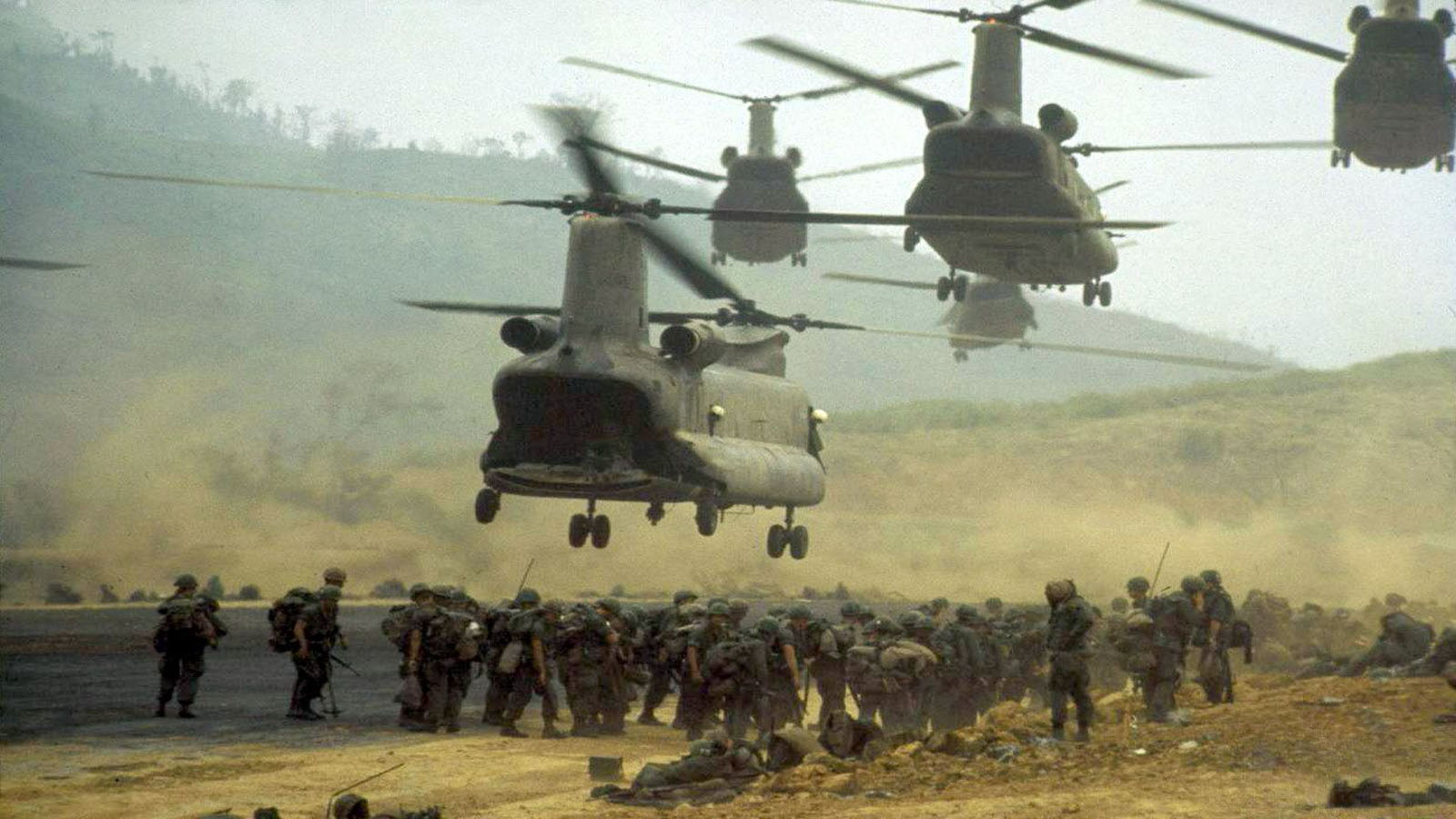
Khe Sanh combat base overview
Khe Sanh combat base is located on National Highway 9 in Hướng Hoá District, Quảng Trị Province, Vietnam, approximately 63km west of Đông Hà town. In 1965-1966, the U.S. military and the Army of the Republic of Vietnam (ARVN) established Khe Sanh as the largest stronghold in the defense line of Route 9, a defensive line considered “invulnerable.”
Khe Sanh is situated in a valley with red soil, elevated 400 meters above sea level, surrounded by rugged hills and mountains on all sides. It was one of the three “thunderbolt” strongholds (Khe Sanh, Làng Vây, and Tà Cơn) in the McNamara Line of electronic barriers. Khe Sanh witnessed significant battles during the 1968 Đường 9 – Khe Sanh Campaign and the 1971 Đường 9 – Southern Laos Campaign. U.S. President Lyndon B. Johnson once requested that the Chairman of the Joint Chiefs of Staff of the U.S. sign a blood commitment to resolve to hold Khe Sanh.
The Tà Cơn base complex, including a makeshift airstrip, preserves numerous facilities related to the 1968 victory, such as exhibition halls, communication trenches, command bunkers, barbed wire fences, runways, aircraft, artillery, tanks, and various other infrastructure.

Role of Khe Sanh combat base
In 1968, Khe Sanh became one of the most famous places in the world, not because of its picturesque landscapes or pristine climate or because it attracted the most foreign tourists. Khe Sanh became famous for the significant battles that occurred in the region during 1967 and 1968.
The year 1968 is when Khe Sanh is most often remembered. It was the time of the Tet Offensive, during which the Viet Cong launched a massive coordinated attack across South Vietnam, one of the world’s largest battles comparable to Concord, Gettysburg, and Normandy. In this campaign, 20,000 North Vietnamese troops were mobilized to besiege 6,000 U.S. Marines and about 200 South Vietnamese Regional Forces soldiers. However, Khe Sanh did not fall. The battle lasted for 77 days, with the Communist forces suffering more than 10,000 casualties.
Since 1962, the U.S. and the South Vietnamese Army (ARVN) had been constructing an air-ground base in a remote valley near the Vietnamese-Lao border, strategically located due to its proximity to the famous Ho Chi Minh Trail supply route. This base was initially used by U.S. Green Berets for reconnaissance missions deep into Laos. The strategic location of Khe Sanh posed significant challenges to North Vietnamese logistics, as it was near the Ho Chi Minh Trail and restricted their movements into South Vietnam.
Following the failure in the 1965-1966 dry season, U.S. Secretary of Defense Robert McNamara conceived the idea of establishing the most modernized anti-infiltration barrier on the southern bank of the Ben Hai River to deter the enemy. McNamara’s idea was researched and developed by a team of 47 top U.S. scientists. After three months of research, the scientific council, under McNamara’s guidance, outlined an ambitious plan:
- The estimated width of the barrier was about 20 km, extending from latitude 17 to Route 9, with a length of over 100 km running parallel to the Ben Hai River from the East Sea to the Sepon (Laos) border. Within this, a flat construction zone of approximately 500 meters in width would be cleared like a soccer field to eliminate any hiding spots for the enemy.
- Construction of a dense network of forts, with a tower every 2 km and a major base every 4 km for a battalion or company-sized unit.
- Deployment of a robust system of defenses, including bunkers, layers of barbed wire fences, and various types of mines: directional mines, disc mines, leaf mines, Claymore mines, illumination mines, and instantaneous detonation mines (the U.S. planned to use 20 million landmines and 25 million small bombs). The barrier was also equipped with advanced electronic equipment like “tropical trees,” “smart machines,” and “human scent detectors.” These were highly sensitive sound detection devices with operational lifetimes of 15 days, 3 months, or 6 months, with one-time battery replacements.
Khe Sanh was identified as the center of this electronic barrier system. Therefore, the U.S. established a powerful, interconnected defensive complex in Khe Sanh-Quảng Trị, including strongholds like Làng Vây, the Hướng Hóa military complex, and the Tà Cơn defensive base.
See more: Vietnamse demilitarize zone
The Tà Cơn complex was the core of the Khe Sanh defense group, covering approximately 5 km in length and 3 km in width. It featured a makeshift airstrip over 3,000 meters long to accommodate C-130 Hercules aircraft and some armed helicopters. The defensive system included robust and interconnected defenses, such as precast concrete bunkers, individual fighting holes with sandbag lids, some concrete bunkers, underground tunnels, a network of communication trenches, combat tunnels, and an extensive system of underground and surface bunkers. Barbed wire fences of various types, minefields, and scattered “tropical trees” (electronic sensing devices) were placed throughout the area. However, North Vietnamese sniper units often took advantage of the moments when U.S. aircraft were landing troops at Tà Cơn’s airstrip to conduct attacks, causing considerable anxiety among U.S. troops with their hit-and-run tactics.
To get to Khe Sanh, tourist can take a private car from Hue to Khe Sanh with Driver

